As we left the South African EEZ, turned on the multibeam system to map bathymetry deployed the magnetometer and started recording gravity measurements as we continued our transit to the first site.
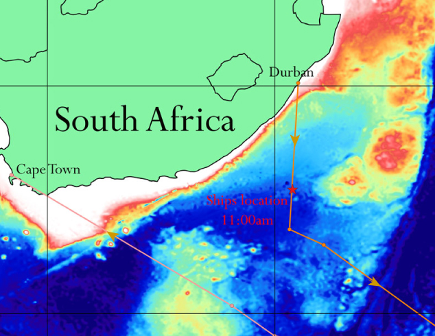
Map showing our location as of 11:00am this morning and our projected ship tracks to and from our survey sites. Red colours indicate shallow seafloor and blue colours deeper sea floor (>4550m). Later in the day, we exited the EEZ and started collecting data.

Dominik getting ready to launch the magnetometer this evening